

FLOOD alerts remain in place in Worcestershire as Storm Christoph causes river levels in the Severn to rise.
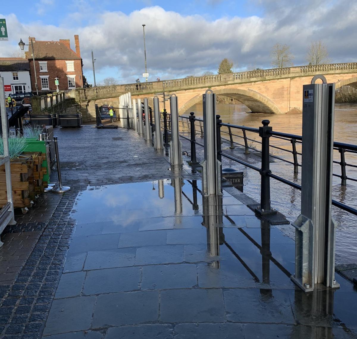
Environment Agency officials from the Worcestershire field team have been in the town today deploying demountable flood barriers at Severnside South, ready for the expected peak on Saturday.
Dave Throup, Environment Agency manager for Herefordshire and Worcestershire, posted on Twitter earlier today: "More flood defences going up at Severn Side South #bewdley this morning.

"Severn expected to peak here on Saturday. Probably about a metre lower than in February 2020."
There are currently 16 flood warnings in place in areas of Worcestershire where flooding is expected, including the River Severn at Upper Arley, and 17 flood alerts where flooding is possible, including the Severn in Bewdley and the Stour, which could impacting Stourport, Wolverley, Cookley, Blakedown and Kidderminster.
According to the Environment Agency, river levels have risen at the Bewdley gauge as a result of heavy rainfall, and flooding of roads and farmland in the area is possible from Highley to Tewkesbury.
Bewdley is expected to peak on Saturday, when the river is expected to reach highs of between 4.2m and 4.7m.

The highest level ever recorded in the town was 5.56m in November 2000. Levels neared this in February last year when temporary barriers were overtopped at Beales Corner.
Flooding is also expected to affect low lying land and roads adjacent to the River Stour from Caunsall to Stourport. Other locations that may be affected include Wolverley and Cookley, Blakedown and Kidderminster.
Levels in the Stour are expected to remain high until Friday.
Further scattered rainfall is forecast over the next 24 hours and experts expect river levels to remain high over the next few days.

An Environment Agency spokesman said: "We are closely monitoring the situation and our staff are checking defences. Please plan driving routes to avoid low lying roads near rivers, which may be flooded."
Several roads across Worcestershire have been affected by flooding already, including Stourport Road in Bewdley.
Inspector Lewis Lincoln-Gordon of West Mercia Police said: "We are currently getting a number of calls in relation to vehicles getting stuck in flood water.
"Please, please do not drive through flood water."
Wyre Forest District Council has sandbags available for residents to collect from Gardners Meadow car park in Bewdley, Vale Road car park in Stourport and the Depot in Green Street, Kidderminster.
Councillor Simon Geraghty, leader of Worcestershire County Council, said: “We have seen some heavy rainfall in parts of the county over the last 24-48 hours in additional as well as considerable rainfall in parts of Wales, which will have an impact on river levels over the coming days.
“With the expected rise in river levels, this could have an impact on some homes and businesses.
“The start to the year has already been a difficult one for many with the national COVID restrictions tightening and we know that some areas of the county will be seeing flooding for the second time in two months.
“Please be assured that our teams are ready and we’re working closely with partners to ensure we have things in place to reduce the impact of flooding on residents and local businesses.”


Comments: Our rules
We want our comments to be a lively and valuable part of our community - a place where readers can debate and engage with the most important local issues. The ability to comment on our stories is a privilege, not a right, however, and that privilege may be withdrawn if it is abused or misused.
Please report any comments that break our rules.
Read the rules here