
TORNADOES have hit Worcestershire for a third time in the space of 10 days after yet another sighting in Kidderminster.
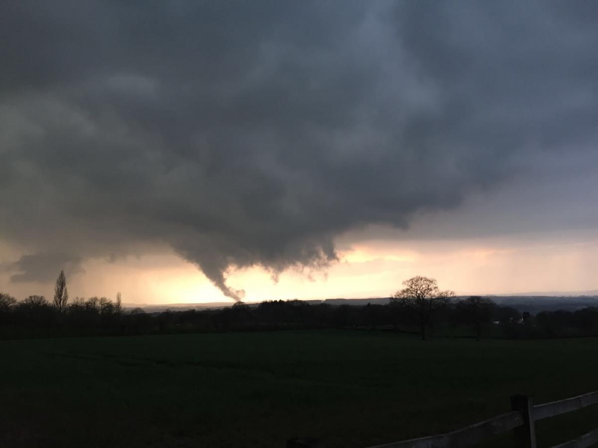
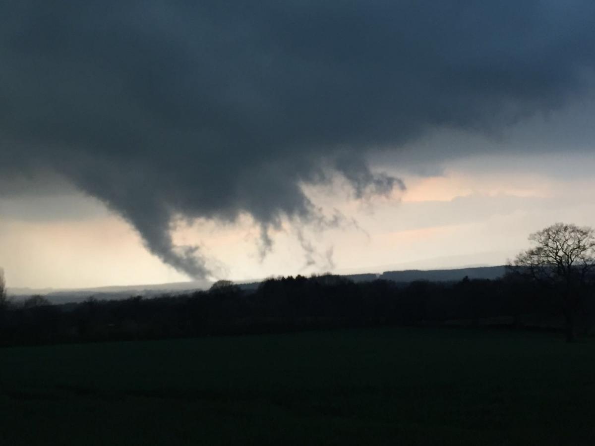
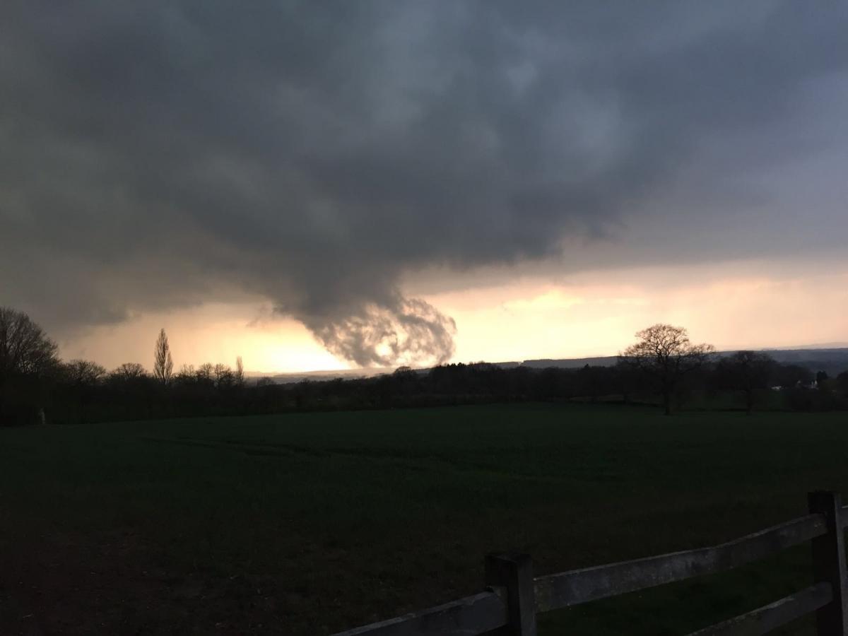
Andy Reynolds, 30, of Pineridge Drive, spotted a supercell thunderstorm in Trimpley at 7.30pm on Thursday, April 14.
It is the third storm to visit the region following a previous sighting on Tuesday, April 5, and another in Hartlebury on Friday, April 8.
Mr Reynolds – a keen storm spotter – believes the latest was around 70-100mph, ranking it as "the best" he has seen and proof that Kidderminster truly is Britain’s Tornado Alley.
He said: "This storm was a very powerful supercell that started off in Droitwich where it produced a funnel cloud, before following it towards Kidderminster where the wall cloud was rotating.
"As I got to higher ground at Trimpley I noticed the funnel was forming again.
"It was definitely stronger than the previous ones we’ve seen and the one in Hartlebury.
"Afterwards we got this wonderful turquoise sky underneath the clouds followed by a hail storm.
"Normally we would rarely get these so it is quite odd how we are getting three supercells so close together – it is not normal.
"But this was the best I have ever seen. Kidderminster definitely is Britain’s Tornado Alley."

(Above: Met Office radar image for April 14 at 7pm)
Supercells are one of the least common yet most severe types of thunderstorm, mostly found in the United States area known as Tornado Alley, but are rare in Britain.
The Met Office confirmed a series of funnel clouds – which allow for the formation of supercell thunderstorms – have been reported across the region in recent days.
A spokesperson said: "Looking at the radar image for 7pm yesterday you can see some pretty hefty showers around the Worcestershire area which could have well been supercells.
"We have also had several reports of large hail and funnel clouds across parts of central and southern England over the past few days.
"The setup we had would have allowed for supercells to develop. These usually occur when winds veer with height, as warm and moist air is overrun by cooler, drier air."


Comments: Our rules
We want our comments to be a lively and valuable part of our community - a place where readers can debate and engage with the most important local issues. The ability to comment on our stories is a privilege, not a right, however, and that privilege may be withdrawn if it is abused or misused.
Please report any comments that break our rules.
Read the rules hereLast Updated:
Report this comment Cancel